LOOK: You Can Now Walk from Intramuros to Quiapo and Ermita via This Riverside Path
It's part of the Phase 4 of the Pasig River Rehabilitation Project.

by Leana Vibal
Published on Oct 20, 2025
(SPOT.ph) Manila City just got a little brighter—and a lot more walkable—as Phase 4 of the Pasig River Rehabilitation Program officially opens to the public.
Filipinos, especially those in Metro Manila, have been dreaming of a greener, more pedestrian-friendly city for years. And while this newly opened 500-meter stretch is just a small step in the grand 25-kilometer plan, it’s still a win in our book. Here’s what you need to know about the newest section of the Pasig River Esplanade.
Also read: A Pasig River Esplanade Walking Tour with Paulo Alcazaren
Check out the newest segment of the Pasig River Esplanade:
Phase 4 of the Pasig River Esplanade—one of the highlight projects under the Pasig River Rehabilitation Program—now runs from behind the old Manila Central Post Office all the way to Arroceros Forest Park.
This new 530-meter stretch comes with pedestrian promenades, bike lanes, viewing decks, kiosks, and transition bridges designed to make the riverside more walkable and welcoming. It also connects earlier segments near Intramuros, Fort Santiago, Plaza Mexico, Liwasang Bonifacio, and MacArthur Park—finally creating a continuous route that links some of Manila’s most iconic heritage, transport, and recreation spots.
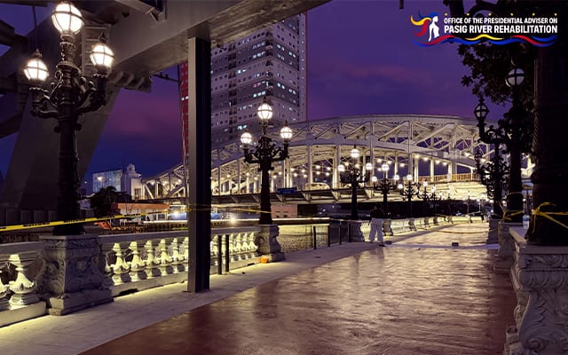
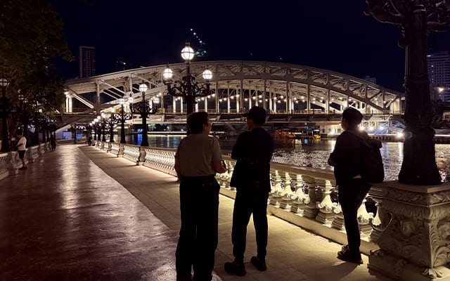
In other words, if you’re sightseeing around Manila, you can now stroll or bike from Intramuros straight to Ermita—snap photos of the skyline, then unwind at Manila’s “Last Lung,” Arroceros Forest Park.
The new path also opens opportunities for heritage and cultural tours, highlighting the Pasig River’s role in connecting historic sites like Intramuros, Quiapo, and Manila City Hall. Along the way, you’ll get sweeping views of Arroceros Forest Park, the Metropolitan Theater, MacArthur Bridge, and Quezon Bridge—each one a reminder of the city’s layered history and evolving energy.
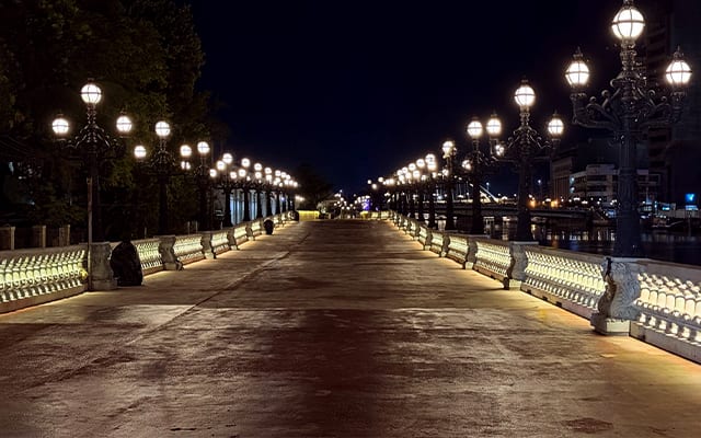

Since the project kicked off in January 2024, the Pasig River banks in Manila have seen a massive transformation. What was once avoided for its dimly lit paths, littered streets, and generally unpleasant walking experience has now become a crowd favorite for late-afternoon strolls.
Beyond the new walkable path, you’ll now find food stalls, public restrooms (with proper plumbing!), plans for modern river transport, and plenty of other upgrades—bringing what was once an eyesore closer to a riverside destination.
What you need to know about the Pasig River Esplanade:
Phase 4 is part of the Pasig River Urban Development Project (PRUDP)—a 25-kilometer makeover that aims to bring the Pasig River back to life within the next three years. The initiative is led by the 15 government entities under the Inter-Agency Council for Pasig River Urban Development (IAC-PRUD), headed by the Department of Human Settlements and Urban Development (DHSUD). This task force hopes to turn what was once one of Manila’s most neglected waterways into a vibrant, walkable stretch the public can actually use and enjoy.
The design is spearheaded by architect Paulo Alcazaren, who’s no stranger to reimagining public spaces—he's the same landscape architect and city planner behind the Iloilo Esplanade. His vision pays tribute to the Pasig River’s legacy as Manila’s original lifeline—back when it served as the city’s main artery for travel, trade, and everyday connection
Also read:
The Pasig River Esplanade Is Finally Here: Here's What to Know
Leana is Spot's go-to for Arts & Culture and Things to Do. On any given day, she’s either glued to her screen—or gliding underwater like the mermaid she swears she is. Contact: leana@spot.ph