

Your Guide To Spilling Levels, Water Flow Of Luzon's Major Dams
So you know when to be alarmed.
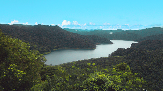
(SPOT.ph) Whenever a typhoon hits the country, flooding inevitably becomes hot topic. Various areas, especially in Metro Manila, have complex interplays of factors contributing to the perennial flooding issues, the release of rainwater from dams one of them.
Dams heavily impact water management during heavy rains, and understanding how they work helps us better prepare for floods. Below is a guide to the water level systems of Metro Manila's dams.
Also read: What to Do Before, During, and After a Typhoon
Guide to the major dams of Luzon and their water level systems
Dams serve multiple purposes. These include power generation, irrigation, and domestic water supply. They help prevent flooding by managing heavy rainfall and controlling its flow into rivers and downstream areas. Ironically, during intense storms, water spillage can still occur, contributing to flooding despite the dams' efforts.
To ensure the safety of people during floods, the Philippine Atmospheric, Geophysical and Astronomical Services Administration (PAGASA) and local government units regularly monitor dam water levels. You can stay updated with PAGASA's real-time updates on the water levels of dams here.
Below, you will find information about the major dams in Luzon.
Angat Dam
Location: Barangay San Lorenzo (Hilltop), Norzagaray, Bulacan
Angat Dam taps into the Angat River, making it the primary source of drinking water for Metro Manila and nearby provinces. It has a minimum operating level of 180 meters. During flood season (May 1 to October 31), the dam's normal high water level is 210 meters, rising to 212 meters outside of this period (December 1 to April 30), according to a study published in UP Los Baños' Journal of Environmental Science and Management.
Water released from the dam is diverted to Ipo and Bustos Dams.
La Mesa Dam
Location: Quezon City
The oldest in the Angat-Ipo-La Mesa water system, La Mesa Dam, is another major source of potable water for Metro Manila and nearby areas. During the rainy season, if the water level exceeds spilling level of 80.15 meters, excess water flows into the Tullahan River, posing a threat of potential flooding to nearby residential areas. It then passes through North Caloocan City, Valenzuela City, Malabon City, and Navotas City before emptying into the vast Manila Bay.
The normal operational level of La Mesa Dam varies between 78 meters and 79 meters.
Ipo Dam
Location: Norzagaray, Bulacan
With a normal high water level of 101.10 meters, the Ipo Dam functions primarily as a diversion dam, directing water from the Angat Dam and the Ipo River to the La Mesa Reservoir and the Balara Filtration Plants. Water travels through concrete tunnels to the Ipo Dam, then flows into three connecting tunnels and settling basins in Bicti and Norzagaray, Bulacan.
Magat Dam
Location: Magat River
The Magat Dam is perched above Magat River—the largest tributary of Luzon's Cagayan River. It irrigitates vast agricultural lands, controls flooding, and generates power through the Magat Hydroelectric Power Plant.
The Cagayan River, the longest in the Philippines, sees water from the dam flow into it, with the dam's spilling level set at 193 meters. This release of water can lead to flash floods in downstream areas of Isabela and Cagayan.
Binga Dam
Location: Itogon, Benguet
Located in the upper reaches of the Agno River on Luzon Island, the Binga Hydropower Plant was built for electricity generation and flood control. As a key component of a cascade system, it operates in conjunction with the Ambuklao and San Roque hydropower plants.
Situated 19 kilometers downstream from Ambuklao, Binga Dam is constructed with a rock-fill structure and an inclined clay core. The reservoir operates within a range of 575 meters at its maximum level and 566 meters at its minimum water level.
Ambuklao Dam
Location: Bokod, Benguet
The Ambuklao Dam, a gravity-based structure on the Agno River, stands 752 meters above sea level. It creates a reservoir of about 7.5 square kilometers and holds 327 million cubic meters of water.
Ambuklao Dam uses three turbines for power and plays key roles in flood control, irrigation, and water storage. The normal high water level (NHWL) is 752 meters, directing water from the Cordillera to the Agno River and downstream to the San Roque Dam in Pangasinan.
Marikina River
Location: Marikina City
While not technically a dam, the Marikina River plays a crucial role in managing water flow in the region. Spanning 27 kilometers, the river not only connects with tributaries but also acts as a conduit, draining into four Rizal municipalities and three Metro Manila cities.
Marikina City uses a three-stage alarm system to manage flood risks on the Marikina River, with water levels measured below the Sto. Niño Bridge:
- Alarm Level 1 is triggered when the water level reaches 15 meters above sea level, signaling residents to prepare.
- Alarm Level 2 occurs when the water rises to 16 meters, indicating that evacuation is necessary.
- Alarm Level 3 is issued when the water reaches 18 meters, requiring a forced evacuation among residents.
Two river monitoring sensors from the Department of Science and Technology are positioned at Tumana Bridge and Sto. Niño Bridge, providing real-time data on water levels. As water levels rise, the local disaster office activates a siren to alert nearby communities.
Pantabangan Dam
Location: Pantabangan, Nueva Ecija
Pantabangan Dam is one of Southeast Asia's largest and cleanest earth-fill embankment dams. Its construction submerged the historic town of Pantabangan, with the town's remnants occasionally surfacing during droughts. The dam rises 107 meters (351 feet) and stretches 1,615 meters (5,299 feet) in length, with its crest elevated at 232 meters (761 feet) above sea level.
The dam plays a crucial role in providing irrigation for local agriculture, generating hydroelectric power, and ensuring a steady water supply for both domestic and industrial needs. It also aids in flood control during heavy rains and typhoons and supports recreational activities such as fishing and boating. The normal high water level (NHWL) at the dam is 216 meters, with water primarily flowing into the Pampanga River when released.
Caliraya Dam
Location: Laguna
In the tranquil towns of Lumban and Cavinti, Laguna, Caliraya Dam stands as a testament to the harmony between nature and human innovation. Originally built in the 1930s to irrigate farmlands, it now powers the region with 28.8 MW of electricity from the Caliraya Hydroelectric Power Plant, much like the Ambuklao and Binga dams. The reservoir operates at a normal water level of 288 meters.
The dam also gave rise to Caliraya Lake, a man-made oasis that has become a popular destination for fishing, boating, and watersports. During heavy rains, the lake’s waters flow into Lumot Lake and Laguna de Bay, seamlessly continuing their natural journey.
San Roque Dam
Location: Pangasinan
San Roque Dam stands tall and proud in the Pangasinan province, serving as a symbol of progress since its completion in 2003 as part of the San Roque Multipurpose Project (SRMP). Towering at 200 meters and stretching 1.2 kilometers (0.75 miles), this massive embankment dam ranks among Asia’s largest. It’s not just a feat of engineering; it’s a lifeline for the region. San Roque Dam generates up to 345 MW of hydroelectric power, nourishes farmlands with crucial irrigation, and offers protection against the region’s floods.