

10 Hiking Trails Near Metro Manila for Weekend Warriors
The perfect activity for long weekends.
Products and services mentioned on our websites are independently selected by our editors. If you buy something through our links, Summit Media may earn an affiliate commission at no extra cost to you.
(SPOT.ph) Remember a time, pre-pandemic, when everyone in your feed was going on hikes? Being constantly surrounded by concrete high rises, bumper-to-bumper traffic, and just trying to keep up with the fast pace of the city, a weekend spent hiking is an exhilarating escape. Luckily for those living in and near Metro Manila, we're a road trip away from several mountains for that much-needed break.
So, if you're ready to fall back in love with hiking, we've listed down beginner-friendly hiking trails to get you started.
Also read:
10 Hiking Destinations in Benguet for Any Type of Hiker
10 Hiking Essentials for Your Next Climb
Here are hiking trails near Metro Manila for beginners:
Mt. Maculot
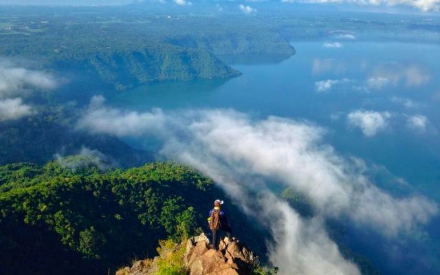
Cuenca, Batangas
MASL: 930
Mt. Maculot has three destinations: the Rockies, the summit, and then the grotto. These landmarks have varying heights (also referred to as Meters Above Sea Level or MASL) and difficulty levels: The Rockies scores 3/9 in difficulty and is 706 MASL, while the summit is at 4/9 difficulty level and is 930 MASL.
If you're looking for the best view of Taal Lake—way different from the ones you can see from the restaurants in Tagaytay, you should definitely plan a day hike traversing the three destinations.
Book a hiking tour of Mt. Maculot via Klook.
Mt. Pinatubo
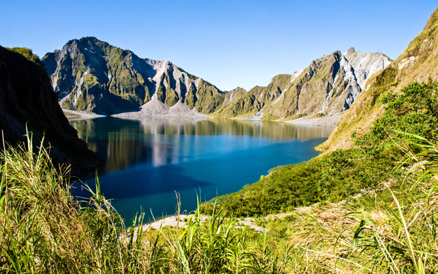
Capas, Tarlac
MASL: 960
Mount Pinatubo is one of the most popular beginner-friendly hikes near Metro Manila—with only a difficulty level 2/9. The Mt. Pinatubo tours first start with a 4x4 ride, a stop at Toblerone Hills, and a trek along long stretches of sand, ash, and small streams before arriving at the final destination, which is the picturesque crater where the lake is.
Book a hiking tour of Mt. Pinatubo via Klook.
Masungi Georeserve
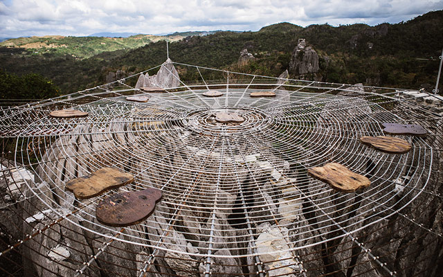
Baras, Rizal
Masungi Georeserve's Discovery Trail is a one-way trail that lets you go through cemented pathways, rope courses, hanging bridges, and resting areas before you reach the summit. Along the trail, you'll pass by the famous "Sapot" or the spider web-like rope and "Yungib Ni Ruben," a cave formation that's part of a karst landscape.
Book a hiking tour of Masungi Georeserve via Klook.
Mt. Batulao
Nasugbu, Batangas
MASL: 811
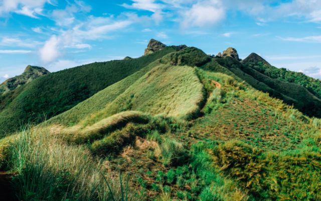
Batulao, also known as "Bato sa Ilaw," is known for its jagged peaks covered in a blanket of tall grass. There are two main trails: Old Trail (more challenging, but still beginner-friendly) and New Trail (easier), and you can either choose only one trail or have a combination of both—if you do, the more common arrangement is that you ascend via Old Trail and descend via New Trail). As intimidating as it may look, traversing Mt. Batulao is considered a minor hike with a 4/9 difficulty.
Book a hiking tour of Mt. Batulao via Klook.
Mt. Gulugod Baboy
Mabini, Batangas
MASL: 525
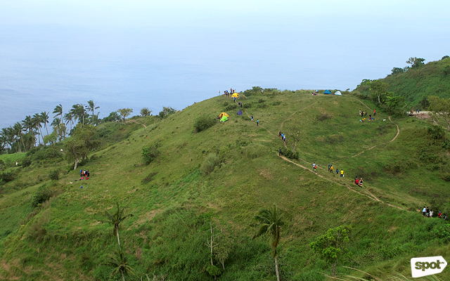
Hiking Mt. Gulugod Baboy, also called Mt. Pinagbanderahan, is considered a minor hike, with a difficulty of 2/9 and a maximum of two hours needed to reach the summit. Because the mountain is located near a bay, going through the trail gives you glimpses of the bay and the rolling hills as you hike. Once you reach the summit and you feel like you don't have the energy to trek back down by foot, you can hire a vehicle to take you back to the campsite.
Book a hiking tour of Mt. Gulugod Baboy via Klook.
Mt. Manalmon
San Miguel, Bulacan
MASL: 196+
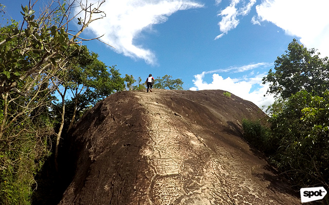
Mt. Manalmon is part of the Biak-na-Bato National Park in San Miguel, Bulacan. Funnily enough, this is not a mountain, as Mt. Manalmon is technically a hill where hikers pass through caves, riverbanks, and forests to reach the summit. Once you reach the summit, you'll see Mt. Gola and Madlum River—and if you're up for a challenge, you can connect the Mt. Manalmon and Mt. Gola trek in one day.
Book a hiking tour of Mt. Manalmon via Klook.
Mt. Mabilog
San Pablo and Nagcarlan, Laguna
MASL: 441
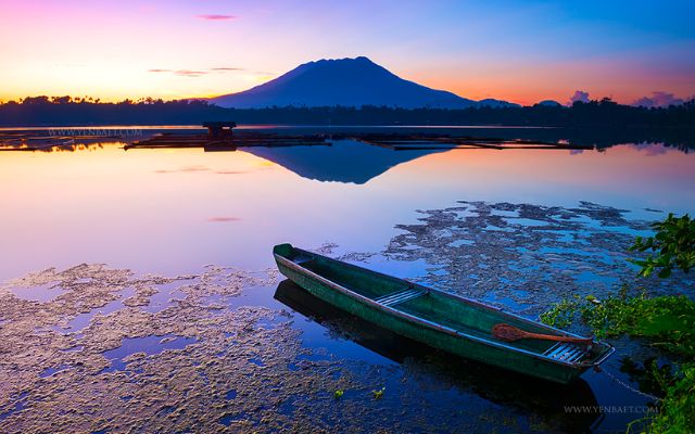
Mt. Mabilog is at the border of Barangay Sta. Catalina, San Pablo, and Barangay Sulsuguin, Nagarlan. There are three commonly known trails: The west trail comes from Sta. Catalina; the south trail starts at Lake Padin in Sto. Angel, which lets you visit two of San Pablo's Seven Lakes; and then there's the east trail, which starts at Lake Yambo shore in Barangay Sulsuguin. This minor climb can either be done as a day hike or as an overnight hiking trip.
Mt. Marami
Maragondon, Cavite
MASL: 405
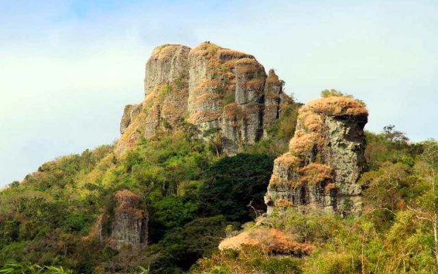
Neighboring Mt. Pico de Loro is another day-hikeable mountain called Mt. Marami, which gets its name from having "many rocks." You can choose between two main trails: the Nuestra Senora Trail, which starts from the west, or the Talahib Trail which starts from the south of Mt. Marami. Best to wear comfortable, quick-dry shoes as you need to cross rivers along the way.
Mt. Sipit Ulang
Rodriguez, Rizal
MASL: 252
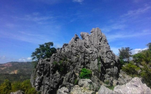
According to the website of the municipality of Montalban, Mt. Sipit Ulang gets its "Sipit Ulang" name as the mountain's rock formation looks like a "petrified huge grab's claw" that's reaching toward the sky. The Mt. Sipit Ulang trail starts in a meadow and then takes you through trees and rocks until you reach the summit, which lends a breathtaking view of other neighboring mountains such as Mt. Pamitinan, Mt. Binacayan, and Mt. Ayaas.
Mt. Romelo
Siniloan, Laguna
MASL: 300
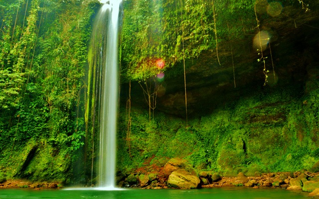
As long it's not raining or didn't rain before your scheduled hike of Mt. Romelo, it should be easy to reach the mountain's summit. This mountain in the town of Siniloan is popular among beginner hikers since you can reach the "summit" or campsite in less than two hours, and second, this mountain's route is accessible. Make sure to take photos by the Buruwisan Falls!
Book a hiking tour of Mt. Romelo via Klook.
Links are updated regularly and as much as possible but note that products can run out of stock, discounts can expire, and listed prices can change without prior notice.
For more discounts and deals, check out Spot's exclusive vouchers.