
10 Gorgeous Hiking Destinations in Cebu, Grouped by the Amount of Grit Needed
These are the trails to add to your bucket list.

(SPOT.ph) The hilly landscape of Cebu lends itself well to hikes. This narrow and slim island—you know what, let’s just call it sexy—spans nearly 200 kilometers from north to south and over 30 kilometers from east to west. With all that space, it is home to some of the most sought-after hiking trails in the country, all of which have breathtaking views that make the climb worth it.
Looking at Cebu on a map, you’ll notice the island’s distinct bolo shape. The northern area looks like the handle, while the southern end traces the outline of a blade. Right at the center of this slim island is its spine, full of jagged, mountainous terrain. That’s right, this area is full of different kinds of hiking trails, from dreamy, beginner-friendly treks to more challenging ground to conquer. For those born or living on this island in the Visayas, it’s a blessing indeed.
And take this bonus with you, a funny little trivia about walking in Cebu: baktas is the Cebuano word for taking a long walk or hike. Now the question is, which part of the body becomes the sorest spot after a day-long hike? It’s the calves. And what is the Cebuano word for calves? Bagtak! Perhaps Cebu is made to be explored on foot after all.
So here’s a list of the 10 best hiking trails in Cebu, grouped by difficulty. The distinctions are made based on the length of the trail and the difficulty of the terrain, such as uphill climbing and crossing boulders and rivers. Whichever path you choose to explore, remember to enjoy yourself at your own pace and never, ever hike in bad weather. Listen to your guides, most of all.
Also read:
10 Beginner-Friendly Hiking Destinations Near Manila
10 Challenging Hiking Destinations Near Manila
These are the trails to go on for your next Cebu hiking trip:
Easy
Sirao Peak or Mt. Kan-irag (Cebu City)
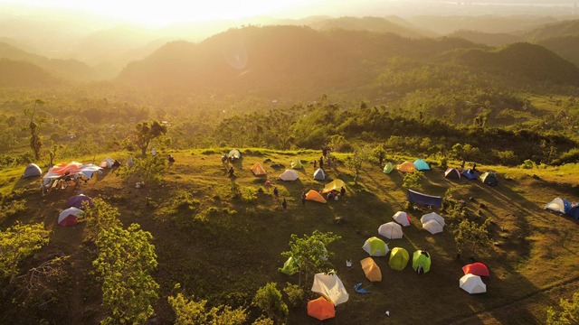
Sirao Peak is dubbed as the “beginner’s stepping stone” or even the “beginner’s favorite.” It’s a five-to-six-hour hike to the top on a trail that’s so well-established and safe that a guide is not all that necessary (as long as you’re open to talking to the locals and have a good sense of direction). The trail starts at the end of the Kabang River, going along the bouldered river system until you reach the mesmerizing Kabang Falls where you can stop and bathe in the cool waters. The hike continues on a trail filled with grasslands bordered by cogon grass and just a few uphill stretches. At the peak, you’ll be rewarded with sweeping verdant plains, with a view of the colorful flower beds of Sirao, the “Little Amsterdam” of Cebu. The sunset view is especially romantic, if you plan to do this with a partner or that teammate you’re crushing on.
How to get there: From Ayala Center Cebu terminal, ride a 13C or 62C PUJ to Talamban. Alight at Julie’s Bakeshop across Sunny Hills Subdivision, cross the street, and go to where the habal-habal (motorcycles) are. Tell them to drop you off at Lower Baogo, which is the jump-off point of the hike.
Alternatively, from JY Square Mall, ride a habal-habal and tell the driver to drop you at Ayala Heights. From there, it’s only a 30-minute hike to the summit. You can do it alone, especially if you’re single and have friends allergic to exercise. This is one of the most budget-friendly trails in this list.
This trail is less than an hour away from Ayala Center Cebu (11 kilometers). For the alternate route, from JY Square Mall, it takes 30 minutes to get to Ayala Heights (14 kilometers).
Osmeña Peak (Dalaguete)
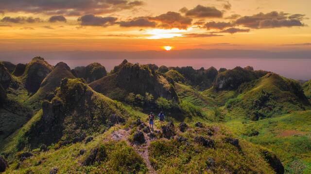
Osmeña Peak is a household name in Cebu when talking about hiking. It has the highest elevation in the island, peaking at 1,013 meters above sea level. From the Mantalungon trailhead, the peak is only an hour or less away, depending on your pace. Since the trail is well marked, it’s easy to recognize, so again, it’s possible to hike without a guide. At first, the trail is easy, almost leisurely, but naturally, it gets uphill the closer you get to the peak. Still, it’s nothing too brutal that it’d leave you gasping for breath or getting leg cramps.
The sights along the way are sure to leave you breathless, though. The endless rolling hills of lush green will probably remind you of Bohol’s Chocolate Hills. There are stony jagged high walls of cliffs screened by shifting fogs, along with marvelous coastline views of the nearby islands of Bohol and Negros. The beautiful cold highlands have earned Mantalungon the name Cebu’s Summer Capital. If you’re doing a day hike, it’s best to stay at the peak and wait for the unforgettable sunset. There are camping spots nearby, so you can stay overnight and wake up to a foggy Osmeña Peak sunrise, but it can get cold; a lot colder if you’re single, so bring either a sweater or a friend you can hug. To get the clearest views, schedule your hike between January to May. Also, the trail can get a little muddy during the wet months, so be prepared.
How to get there: From the city’s south bus terminal, hop on a bus bound for Dalaguete and tell the conductor to drop you off at the junction for Osmeña Peak. Once there, ride a lovely habal-habal or tricycle that will bring you to Barangay Mantalungon, where the trailhead to Osmeña Peak starts.
Dalaguete is nearly three hours away (86 kilometers) and Barangay Mantalungon is a further 21 minutes away (11 kilometers).
Mt. Naupa (Naga)
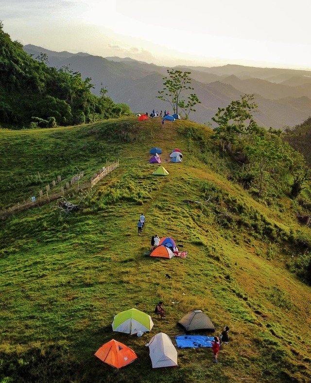
Mt. Naupa is much loved by newbie hikers and seasoned mountaineers alike because it offers them a quick getaway trek, one that is not exhausting, heck, maybe even reenergizing. It often takes less than an hour to reach the peak, which sits at around 500 meters above sea level. So those who are agoraphobic need not to worry. It’s not that high. Kidding aside, don’t let the altitude fool you—it is the highest in Naga! Mt. Naupa is famous for its almost perfect cone and the occasional sea of clouds surrounding it. It’s also a favorite campsite, with its splendid vantage points for views of the sunrise and sunset. Throughout the day, the sun paints the rolling, grassy hills of Naga with its changing hues—something magical you can witness as you’re sitting atop Mt. Naupa’s peak. The trail is straightforward, so it’s hard to get lost (unless you’re truly hopeless; we believe in your common sense). If you want to spice up your hike, feel free to get a guide and try out forking trails leading to other sites like Campo Cuatro and Siete, Lanas, and Matun-og Falls.
How to get there: From the South Bus Terminal, take a bus or PUJ bound for Naga or Carcar City. Ask the conductor to drop you off at The Sisters of Mary School, Minglanilla. Once there, look for Lolo Tinong’s Bakeshop sitting at a street corner, where you’d ride a habal-habal en route to the Barangay Cogon Chapel, where your hike begins.
The landmark, The Sisters of Mary School, is around 40 minutes away from the terminal (15 kilometers), and from Tinong’s Bakery, the Barangay Cogon Chapel is around 20 minutes away (7.6 kilometers).
Mt. Mago (Carmen)
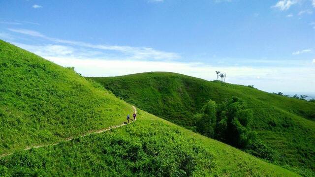
The one-hour habal-habal ride to Mt. Mago’s jump-off point wonderfully sets the mood for this one-to-two-hour hike. The sloping road’s scenery is filled with long lines of pine and molave trees, with stretches of farmlands and ranches, flavoring the air with their fresh sweet scent. While Mt. Mago has the relatively easiest trail on the list—it’s uphill and downhill—what makes it challenging is that the trail is not much shaded with tall trees. You’ll mostly tread on seemingly infinite patches of green grass, or muddy ground if it’s rainy. It’s also best if you have a guide since the trails can be a little confusing because the areas look the same.
If it’s a sunny day, bring lots of water and sunscreen, and be prepared for an abundance of light and heat. But under pleasant weather, it’s a laid-back, breezy, almost leisurely hike. Since there aren’t many huge trees, you have a nearly unobstructed view of the neighboring hills swimming in a sea of bright-green hues. Interestingly, Mt. Mago’s boundary is shared by Danao, Carmen, and Tuburan, so it’s like traveling to three places at once. From its peak, which sits at 755 meters above sea level, you’ll find the boundary marker dividing the three municipalities.
How to get there: Hop on a Carmen-bound bus at the Cebu North Bus Terminal and tell the conductor to drop you off at the Carmen Public Market, where you can ride a habal-habal to Santican Barangay Hall, where you’d begin hiking.
The Carmen Public Market is around an hour away from the North Bus Terminal (36 kilometers), and from there, the Santican Barangay Hall is more or less an hour away (15 kilometers).
Moderate
Bocaue Peak (Brgy. Bonbon, Cebu City)
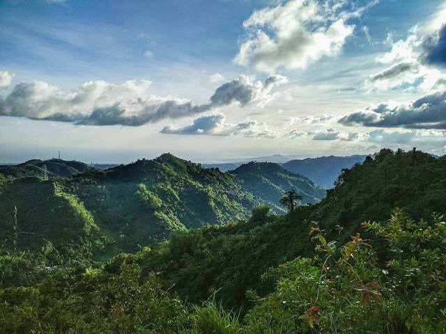
Bocaue Peak is located in Bonbon, a mountainous barangay in Cebu, and is also known as the Muffin Peak, so-called because it looks like the sweet treat when you look at it from the foot of the mountain. It does have a sweet view, though! You’ll be treated to a 360-degree view of the city, filled with all the lush greenery that nature has to offer.
There are two popular trails to the peak, both of which begin from Sitio Napo in Barangay Guadalupe. The Babag Trail goes through the Babag Range and is popular with mountaineers. Meanwhile, the Five Towers Trail is called as such due to the series of communication towers lining it. Of the two, the latter is not as well-established a path, so it’s definitely more challenging, especially now that there are still a couple of fallen trees blocking the trail (remnants of Odette).
The hike to the peak takes four to five hours, with an additional one to two hours to go down. You may also choose to spend the night and wake up to the view surrounding you from all sides, as soon as the dawn fog clears. It can get really cold at night, though, owing to the thick vegetation, so make sure to bring plenty of protection from the cold. There is also no credible water source, so make sure to bring your own supply and hydrate well.
How to get there: From Ayala Center Cebu, ride any jeepney going to Barangay Guadalupe (they typically start with a 06 route code), alighting at the Our Lady of Guadalupe Parish Church. From there, ride a habal-habal to Sitio Napo in Sapangdaku, where the trails to the peak begin.
The Our Lady of Guadalupe Parish Church is just 15 minutes away from Ayala, and from there Sitio Napo is less just 5 minutes away (1.4 kilometers).
Mt. Manunggal (Balamban)
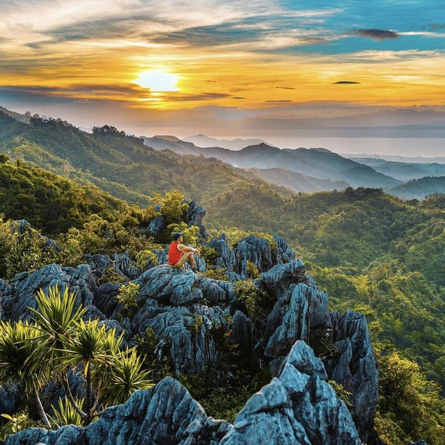
Mount Manunggal is associated with an important historical event. This is the site where President Ramon Magsaysay’s plane crashed in 1957. It’s no wonder then, that it has since been hailed as the most historic mountain of Cebu. It’s also the highest mountain top on the island, rising to 3,559 feet above sea level.
Today, the mountain has transcended its reputation and become a haven for hikers, mountaineers, and campers. There’s a campsite inside the Baguio de Cebu Eco Adventure Park, with comfort rooms and plenty of fun activities you can try. From the campsite, it takes 30 minutes to reach the peak of the mountain. Along the trail, you’ll find a monument built to honor the late president and all who perished in the 1957 crash.
The trail can be rather steep at times, so always make sure you have a firm foothold. If there’s been rain, beware of muddy areas that can make you slip. At the peak, you’ll find jagged limestone promontories with deep crevices where ferns and shrubs thrive. Mount Manunggal is part of the long mountain range of Cebu’s central spine, which is why you’ll find the view at the top to be filled with mountains. Listen to the hushed tones of Mother Nature as the constant fog rolls in.
How to get there: From the terminal at Ayala Center Cebu, ride a van going to Barangay Tabunan, Eskina Mount Manunggal. From there, hire a habal-habal going to the entrance to the campsite.
Via Cebu Transcentral Highway, Barangay Tabunan is about an hour away from Ayala (nearly 31 kilometers), and from there, the Manunggal Campsite entrance is 40 minutes away (nearly 20 kilometers).
Mount Babag (Cebu City)
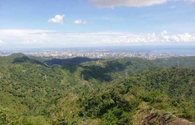
Mount Babag has historically been a natural lookout spot due to its vantage point. In the past, it was used by Cebuano resistance fighters against the Spanish, Americans, and the Japanese. Plenty of forgotten battles have occurred in this mountain. Today, it’s a popular hiking spot for many. The trail starts out easy but can get quickly challenging as you go along, with plenty of steep spots. Not to worry, though, as there are some stopovers where you can catch your breath and chat with the friendly locals, along with their precocious dogs. The hardest part of the trek will probably be an incline that tilts to up to 70 degrees. You’ll be treated to plenty of beautiful panoramas though, such as the RCPI Towers, especially when you reach the summit. At the top, you can take in the view of the surrounding mountainside while nesting under the cool shade of a tree, or perhaps taking your turn to rest at the summit’s popular duyan. Some hikers continue on to Mount Kan-irag from here.
How to get there: Ride any jeep going to the Our Lady of Guadalupe Church. From there, hire a motorcycle to take you to Napo, the jump-off point to the hike to Mount Babag.
By car, the Guadalupe Parish Church is just 15 minutes away from Ayala, and from there Sitio Napo is less just 5 minutes away (1.4 kilometers).
Hard
Mt. Mauyog (Balamban)
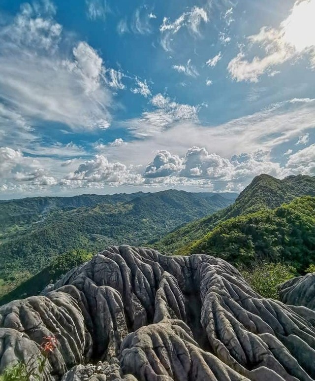
Rising at 1,027 meters above sea level, Mount Mauyog in Balamban is famed for its unique rock formation at its summit, often described as resembling that of a brain’s texture in gray. This mountain is definitely not for inexperienced hikers as it has a steep and narrow trail. There are also huge rocks and boulders to clamber over, so make sure you have the upper body strength for it. However, if you’re up for it, you’ll be rewarded with (quite literally) breathtaking sights, even from halfway up the climb. Once you reach the top, you’ll be even more amazed by the different shades of green spreading out below on all of creation. You’ll be tempted to just sit on the rocks and enjoy the breeze, losing yourself to such a beautiful sight, perhaps almost forgetting that you only just left the city behind.
How to get there: From the terminal at Ayala Center Cebu, ride a V-hire and alight at the junction at Barangay Cantipla, then hire a habal-habal to Tabunan, where the hike starts. This is called the Sunog trail.
Via Cebu Transcentral Highway, the Barangay Cantipla junction is about an hour away from Ayala (24.6 kilometers), and from there, Tabunan is around 10 minutes away (4.2 kilometers).
Spartan Trail (Banawa to Pamutan Cebu City)
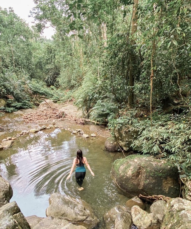
There’s a reason why it’s called Spartan Trail. That’s right, think of those buff and battle-scarred warriors from the movie 300. For them, this trail would be a piece of cake. For us mere mortals, on the other hand, not so much. Among the most challenging trails in this list, you’ll need to be of particularly sound mind and body to conquer this path. It takes about two and a half hours to complete and involves steep inclines and some rough vegetation. The trail usually begins near the statues of the Good Shepherd in Banawa. There are plenty of beautiful wildflowers and unique-looking trees along the path to cheer you on as you struggle with your climb. A creek crossing gives you a bit of a cool break amidst the heat of the mostly open trail. At the summit, you will witness the beauty of Cebu’s skyline, spreading before you in all its glory. Some hikers push on to Mount Babag or Bocaue Peak from here.
How to get there: From Ayala Center Cebu, ride 12L and alight at Banawa and start your hike from Paseo Arcenas or Good Shepherd. Paseo Arcenas in Banawa is more or less 15 minutes away from Ayala.
Mt. Kapayas (Catmon)
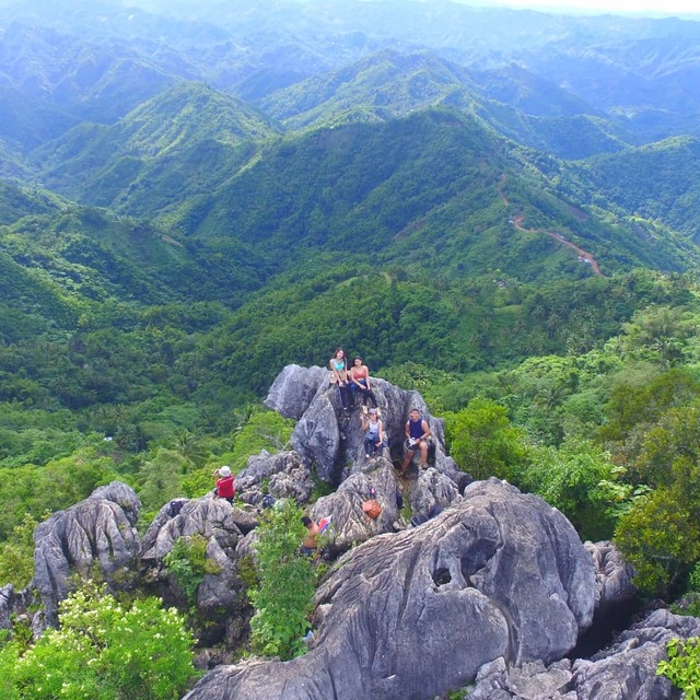
Hailed as the second highest peak in Cebu, Mount Kapayas offers a rush like no other. At the beginning of the trail, you’ll be immediately greeted by a steep incline and after a while you’ll be rewarded by the cool waters of a stream. You’ll pass by Barangay Kabangkaya with its small collection of houses, pushing onto a small hill. And this is not even the hardest part yet. You will then traverse an open plain where you’ll be exposed to the elements before nestling under the cool shade of a deep forest. Needless to say, the path can be rocky and challenging. The highest rock at the peak is called the Torre, from where you’ll be afforded with a sweeping view of Cebu, and perhaps begin to understand just how beautiful this island can be in its untouched state
How to get there: From Cebu North Bus Terminal, ride a bus going to Catmon, then alighting at Catmon Proper. From there, you can hire a habal-habal to Sitio Kampanya, in Barangay Kabangkaya.
Catmon Proper is an hour-and-half ride away from North Bus Terminal (52 kilometers), and from there, Sitio Kabangkaya is less than 30 minutes away.