
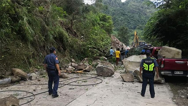
(SPOT.ph) People in Northern and Northeastern Luzon were woken up by a magnitude 7.3 earthquake on Wednesday morning, July 27, as reported by the Philippine Institute of Volcanology and Seismology. The seismic activity was felt in Metro Manila with Quezon City registering Intensity IV. But this is not the first, and definitely not the last. The Cordillera Regional Disaster Risk Reduction and Management Council on Thursday afternoon, August 4, released five worst-case scenarios should the active fault lines in Kalinga, Bangui, Tubao, and other nearby faults see significant movement.
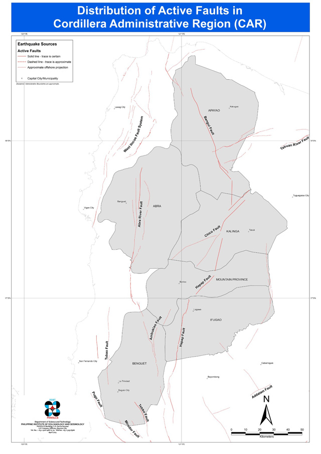
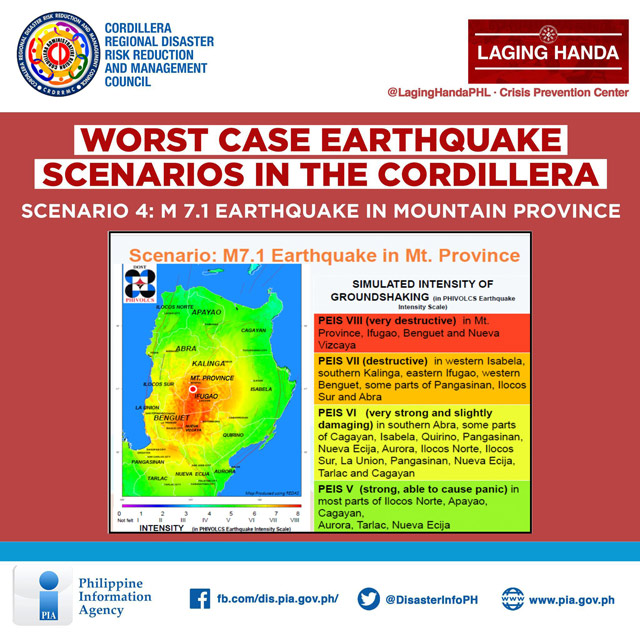
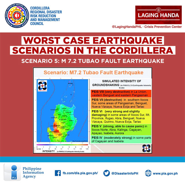
The scenarios are based on the Cordillera Regional Disaster Response Plan for Earthquake 2019, which came from the simulation of the Rapid Earthquake Damage Assessment by the Philippine Institute of Volcanology and Seismology (PHIVOLCS). The illustrations show the magnitude, a measure of the size or amplitude of seismic waves generated by an earthquake source; and the intensity (specifically the PHIVOLCS Earthquake Intensity Scale), which describes the severity or degree of shaking in terms of its effect on structures and humans.
Also read:
What to Do After an Earthquake
Twitter, NDRRMC, and Google Alerts: How to Get Earthquake Alerts
PHIVOLCS Associate Scientist Dr. Arturo Daag said that an Intensity VIII earthquake is impossible in a place near a fault that moved.
"Kung gaano kahaba ang fault, mas malaki ang magnitude potential niya," he explained.
Office of Civil Defense - Cordillera Planning Officer Ferdinand Tamulto, on the other hand, reminded the public not to panic. "Unang-una, hindi po natin alam kung saan at kailan puwedeng tumama ang mga lindol na puwedeng makaapekto sa atin kaya dapat 'yung ating paghahanda ay araw-araw at tuloy-tuloy," he said.
PHIVOLCS clarified that earthquake scenarios are not earthquake predictions.
Worst Case Scenarios of Northwestern Luzon Earthquake, According to CRDRRMC
Scenario 1: Magnitude 6.7 Earthquake along Kalinga Fault
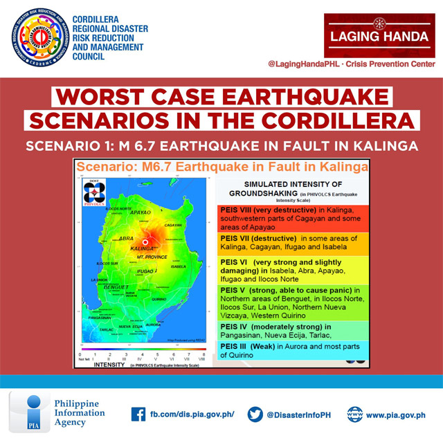
Scenario 2: Magnitude 7.2 Earthquake along Bangui Fault
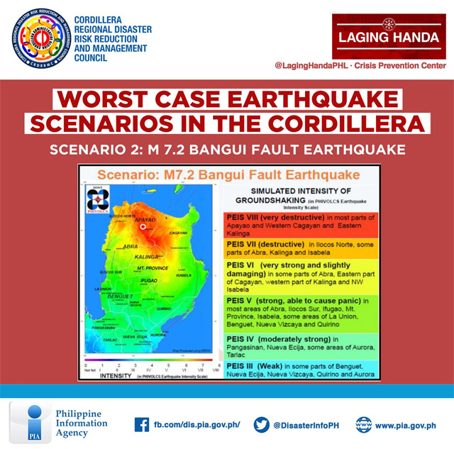
Scenario 3: Magnitude 8.0 Cagayan Earthquake
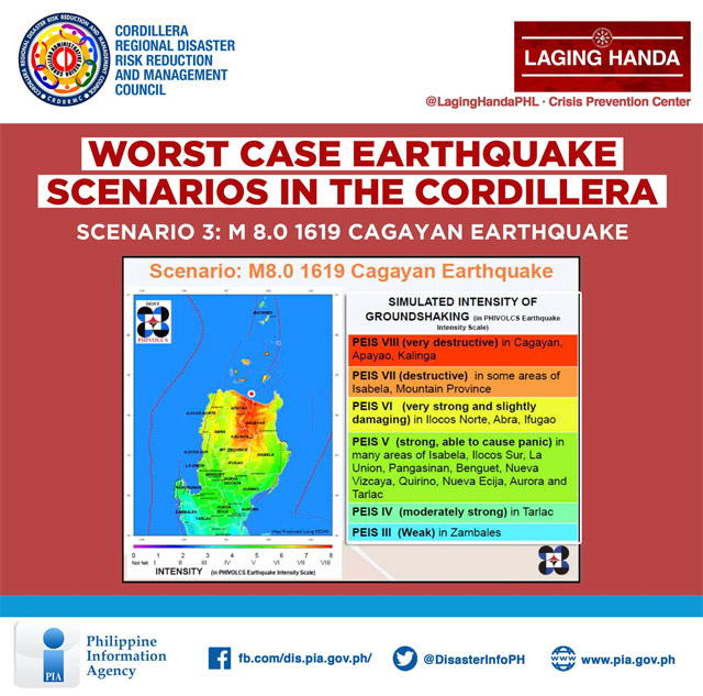
Scenario 4: Magnitude 7.1 Mountain Province Earthquake
Scenario 5: Magnitude 7.2 Tubao Fault Earthquake
1990 Luzon Earthquake
The magnitude 7.3 earthquake in Abra on July 27 brought back memories of the Luzon Earthquake that struck the country on July 16, 1990, especially with the similarity in their months. The previous incident was reported to have a magnitude of 7.7 with a maximum Mercalli intensity scale of IX (violent).
Italian volcanologist Giuseppe Mercalli developed the Mercalli intensity scale in 1902, and this seismic intensity scale later evolved into the Modified Mercalli intensity scale. The Philippines is now using PEIS, which was implemented in 1996, replacing the Rossi–Forel scale (used for two decades in the late 19th century until the introduction of the Mercalli intensity scale).
The 1990 Luzon Earthquake produced a 125-kilometer-long ground rupture from Aurora to Nueva Vizcaya. Its epicenter was near the town of Rizal in Nueva Ecija, but fatalities (an estimated 1,621 people) were located throughout Central Luzon and the Cordilleras. Several buildings in Baguio City collapsed, including the Hyatt Terraces Baguio Hotel, which had a widely circulated photograph after at least 80 hotel employees and guests were killed. Cabanatuan City's tallest building, the Christian College of the Philippines, collapsed during school hours. Dagupan City had 90 damaged buildings and 20 more that completely collapsed. La Union had up to 100,000 families displaced when two coastal villages sank because of liquefaction.